
DJI Matrice 400: The New Powerhouse in Enterprise Drone Technology
DJI Enterprise has unveiled its latest flagship drone, the Matrice 400 (M400), a powerful solution built for demanding commercial and industrial operations. With the flight battery installed, the DJI Matrice 400 weighs approximately 9.8kg. It delivers 59 minutes of maximum flight time and supports up to 6kg of total payload capacity. It can be configured with 7 individual payloads, making it ideal for heavy-lift industrial drone operations. As the first in the Matrice series to feature both integrated horizontal rotating LiDAR and 6-directional mmWave radar, the M400 sets a new benchmark in 24/7 obstacle detection and autonomous navigation.
The Matrice 400 is a true evolution of its predecessors, significantly enhancing payload capacity, onboard intelligence, and operational durability, broadening its versatility across a wide range of applications. The DJI Matrice 400 is a next-generation enterprise drone designed for emergency response, public safety, power line inspections, geospatial mapping, mining, and construction, delivering advanced performance across critical industries.

First Impressions
The first thing I’m drawn to after taking the Matrice 400 out of the box is its size. Unfolding the beast, we see it is big. Even sitting next to the Matrice 350 RTK, the 400’s predecessor and very similar airframe, the 400 dwarfs it. There is an increase of almost 200mm in its length and 100mm in its width compared to its older sibling, a testament to the increase in power and versatility. A closer look at the airframe reveals several key upgrades: a front-mounted rotating LiDAR puck atop the fuselage, redesigned propeller blades, integrated first-person view within the colour obstacle avoidance cameras, and a new unified battery system that replaces the dual-battery setup from the M300 and M350 with a single, removable high-capacity battery. While the new single-battery system simplifies logistics, our initial tests found it slightly tight to insert and remove. However, with use, the plastics are expected to wear in, making battery removal easier over time.
Despite its increased power and size, one of the most surprising aspects of flying the DJI Matrice 400 was how quiet it is. The newly designed propellers aren’t silent, but they produce less noise than the M350, with a lower-pitched sound profile. Flight performance is equally impressive; the M400 retains the same smooth, responsive control as its predecessors. Acceleration feels similar to the M350, but the M400 achieves noticeably higher top speeds. Overall, flying the M400 felt familiar yet refined, allowing existing DJI Enterprise users to transition with ease.

Watch our unboxing and first impression video below:
DJI Matrice 400 Specifications Overview
Let’s explore the key specifications of the DJI Matrice 400 and compare them to its predecessor, the Matrice 350 RTK. Released just two years apart, the Matrice 400 introduces major advancements in drone technology, offering superior performance, enhanced payload support, and upgraded obstacle sensing capabilities that significantly surpass the M350 RTK.
| Spec. | Matrice 400 | Matrice 350 |
|---|---|---|
| Max Flight Time | 59 min | 55 min |
| Max Speed (forward) | 25 m/s | 23 m/s |
| Payloads | 7 payloads, 6 kg max | 3 payloads, 2.7 kg max |
| Weight (with battery/s) | 9.7 kg | 6.5 kg |
| Maxmimum Takeoff Weight (MTOW) | 15.8 kg | 9.2 kg |
| Battery Number | 1, hot swapping compatible (GNSS system remains powered up for 45 seconds) | 2, hot swapping compatible |
| Ingress Protecting Rating | IP55 | IP55 |
| Operating Temperatures | -20° to 50° C | -20° to 50° C |
| Obstacle Sensing | Six-directional visual sensings, six-directional mmWave radar, 360° rotating LiDAR | Six-directional visual sensings |
| Max Transmission Range | 20 km (CE), (40 km total) | 8 km (CE), (20 km total) |
| Video Transmission | O4 Enterprise Enhanced Video Transmission System, triple-channel 1080p/60fps | O3 Enterprise Video Transmission System, triple-channel 1080p/30fps |
| Controller | DJI RC Plus 2 Enterprise Enhanced | DJI RC Plus |
| Software Compatibility | DJI Pilot 2, DJI FlightHub 2, DJI Terra, DJI Modify | DJI Pilot 2, DJI FlightHub 2 (Limited), DJI Terra, DJI Modify |
| Open Developer Ecosystem Compatibility | Intelligent Algorithm Developer, Payload SDK, Mobile SDK, Cloud API, Open Data Access | Payload SDK, Mobile SDK, Cloud API |
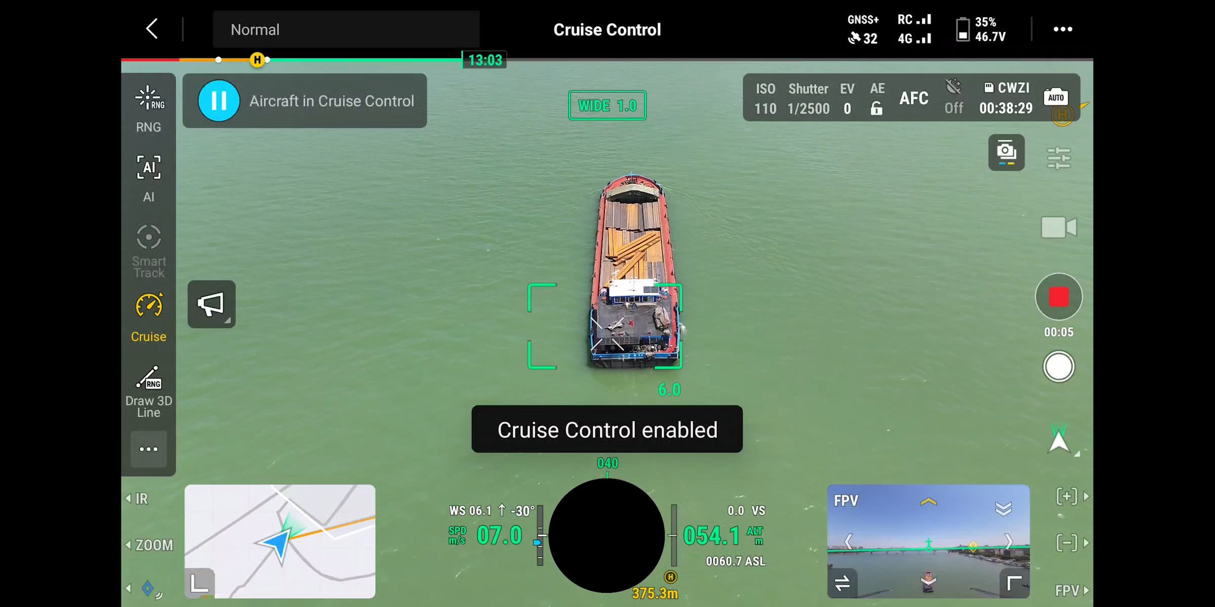
Improved Flight Time and Speed
As mentioned above within the table, the Matrice 400 is capable of achieving 59 minutes of forward flight time with a Zenmuse H30T payload attached. Comparing this to the performance of the M350 with a similar single payload equipped, the effective operation time is increased by 50%, enabling higher efficiency in long-duration missions
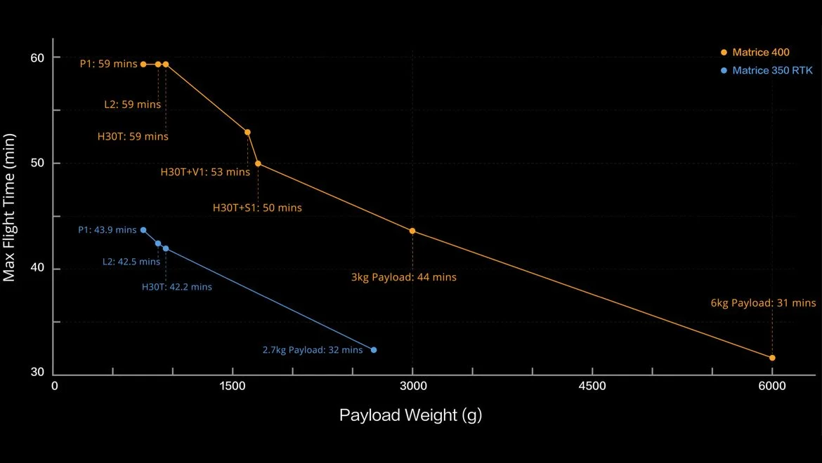
Estimate the Matrice 400’s flight time based on payload configuration


Comprehensive Payload Options
The aforementioned high lift capacity of up to 7 payloads of 6kg weight is what defines the Matrice 400 as a beast. A fusion of the versatility of the 300 and 350’s seamless switching of multiple gimbal-supported payloads and the heavier lift capabilities seen in the much more mature Matrice 600. The 400 is capable of supporting 1 to 3 downward gimbal payloads, single or dual gimbal on the front and a single gimbal on the aft. E-Port 4 can connect to an E-Port Hub Expansion Plate to expand to four payload ports, supporting up to 7 payloads.
DJI has a line of compatible gimbal payloads for the M400, the Zenmuse and Manifold series. The M400 currently supports the following first-party payloads:
DJI Zenmuse L2 LiDAR + RGB for survey-grade colourised LiDAR point clouds
DJI Zenmuse P1 45MP Full-Frame Camera for survey-grade photogrammetry
DJI Zenmuse H30 Series for industry-leading zoom and thermal capabilities
DJI Zenmuse S1 spotlight
DJI Zenmuse V1 speaker
DJI Manifold 3, a high-performance onboard computer
The M400 is also compatible with third-party PSDK payloads that were already developed for the M350 RTK aircraft; however, PSDK payloads need to be upgraded by the corresponding manufacturer.
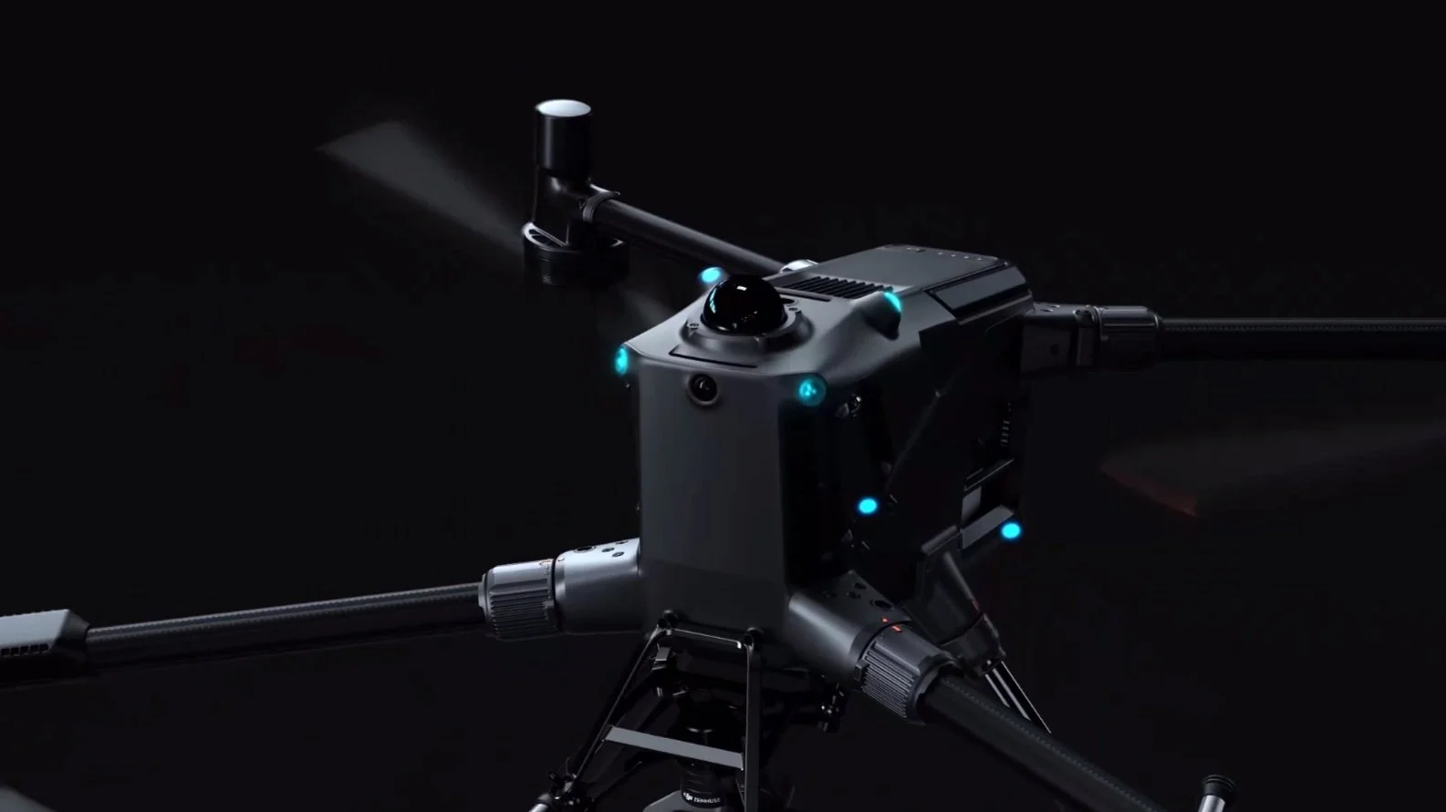
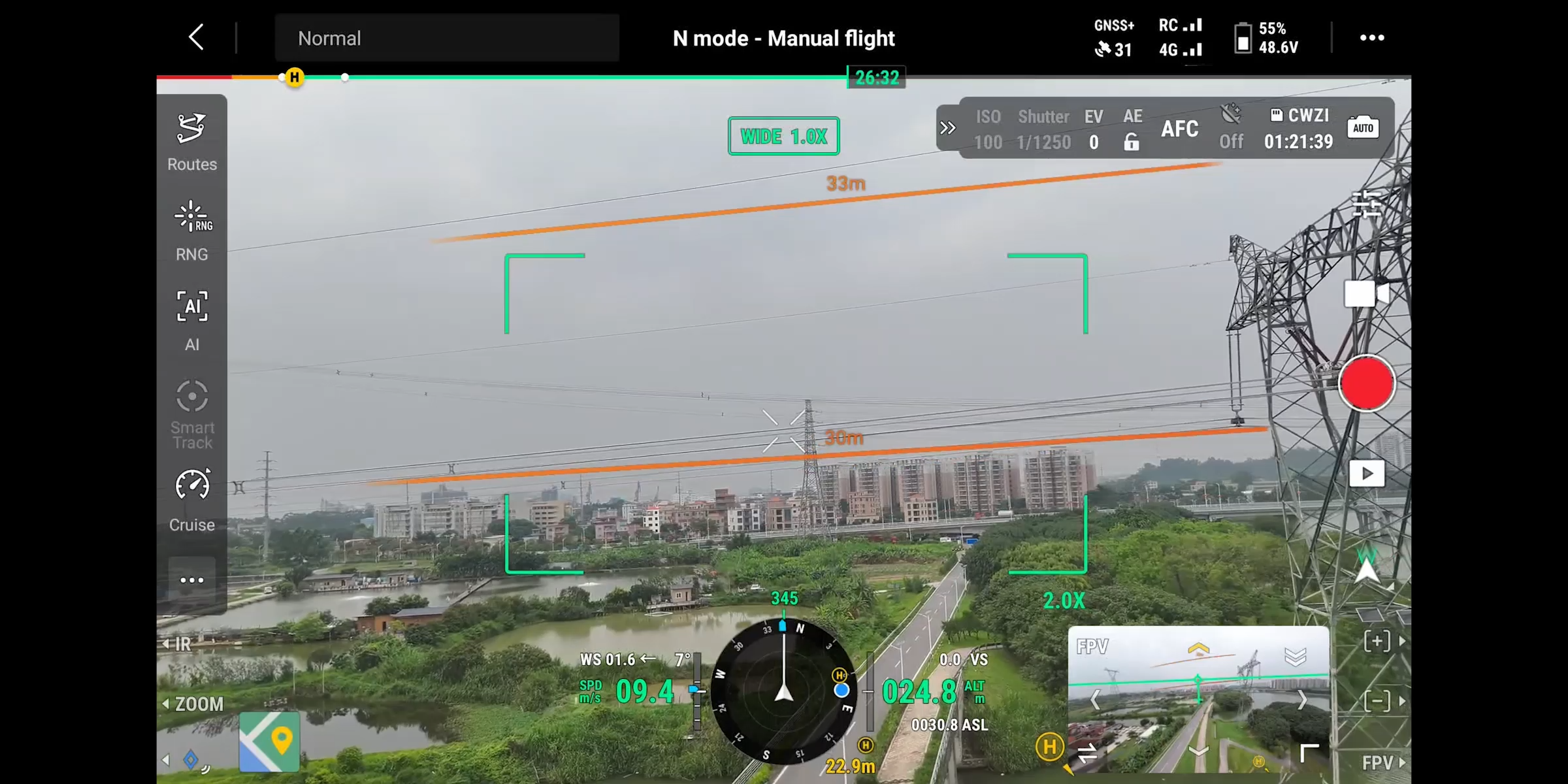
Revolutionary Obstacle Detection on the DJI Matrice 400
Engineered for mission-critical operations, the DJI Matrice 400 features one of the most advanced obstacle detection systems ever integrated into an enterprise drone. It combines LiDAR, mmWave radar, and full-colour vision sensors to enable reliable navigation across even the most complex environments.

Horizontal Rotating LiDAR (360° Awareness)
Detects thin objects like power lines, even at night
Detection Range: Up to 100m standard; 35m for 21.6mm power lines
FOV: 360° horizontal, 58° vertical
Delivers high-precision 3D depth data for advanced situational awareness
Point Frequency: 520,000 pts/sec; Class 1 Eye Safety Laser
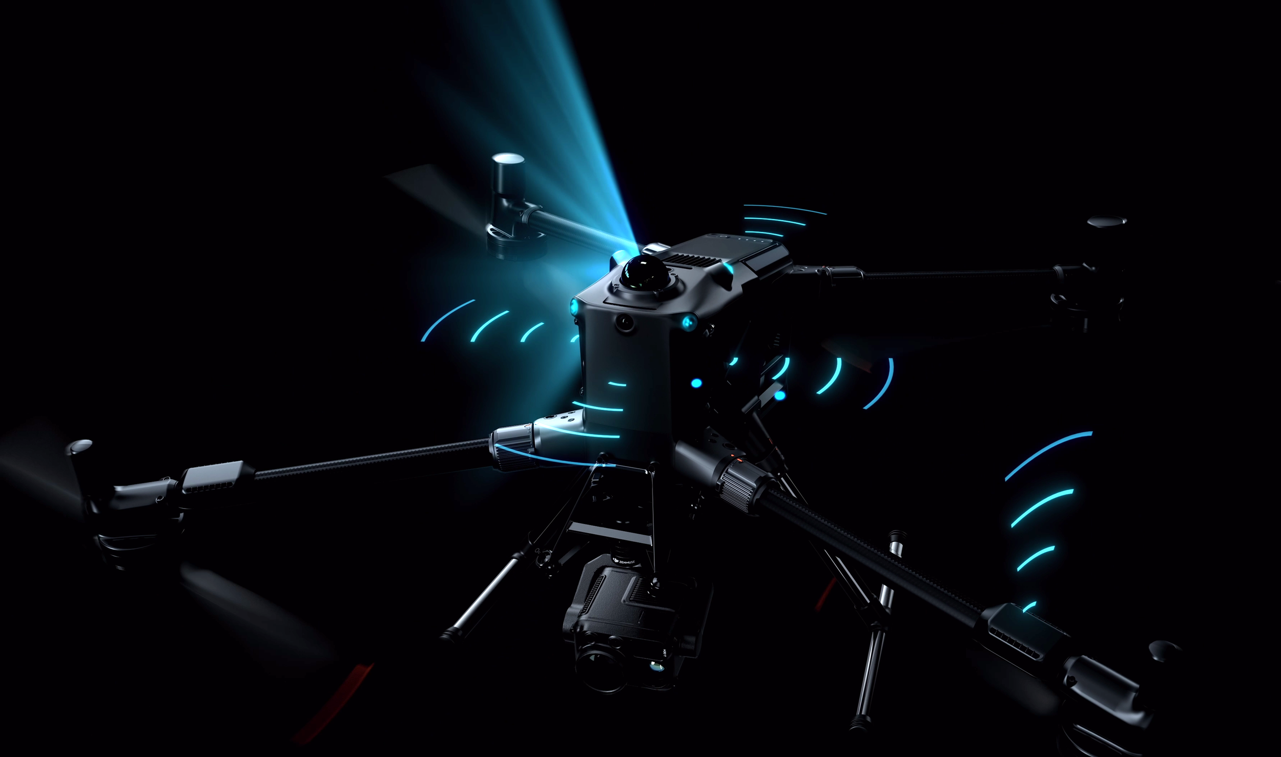
Six-Directional mmWave Radar (All-Weather Sensing)
Embedded in six directions (up, down, front, back, left, right)*
Strong penetration in fog, rain, snow, and smoke
Effective for detecting thin power lines at up to 50m
Operates at ±45° FOV both horizontally and vertically
Ideal for low-visibility or GNSS-denied environments
* As highlighted by the blue waves
Full-Colour Fisheye Vision System (Enhanced Visual Context)
Four low-light fisheye cameras for omnidirectional vision
Captures colour, shape, and texture, improving object recognition
Enables visual positioning in GNSS-compromised environments
Performs best in daylight and well-lit conditions
More Obstacle Detection and Safety Features
-
Brake & Avoid: Real-time re-routing or braking when obstacles are detected
Reliable even when flying directly toward power lines at 25 m/s
Detects both primary (21.6mm) and secondary (12mm) lines—even at night
-
Combines LiDAR, radar, and vision for omnidirectional awareness
Enables safe operation near glass buildings, turbine blades, or under bridges
Supports Return-to-Home with unmatched reliability in complex environments
-
Arm Lock & Battery Lock Sensors: Prevent takeoff if improperly secured
Three-Propeller Emergency Landing Mode: Safe descent in the event of motor failure
ADS-B AirSense Receiver: Alerts pilots to nearby manned aircraft
Dual Anti-Collision Beacons: Improve visibility in night operations
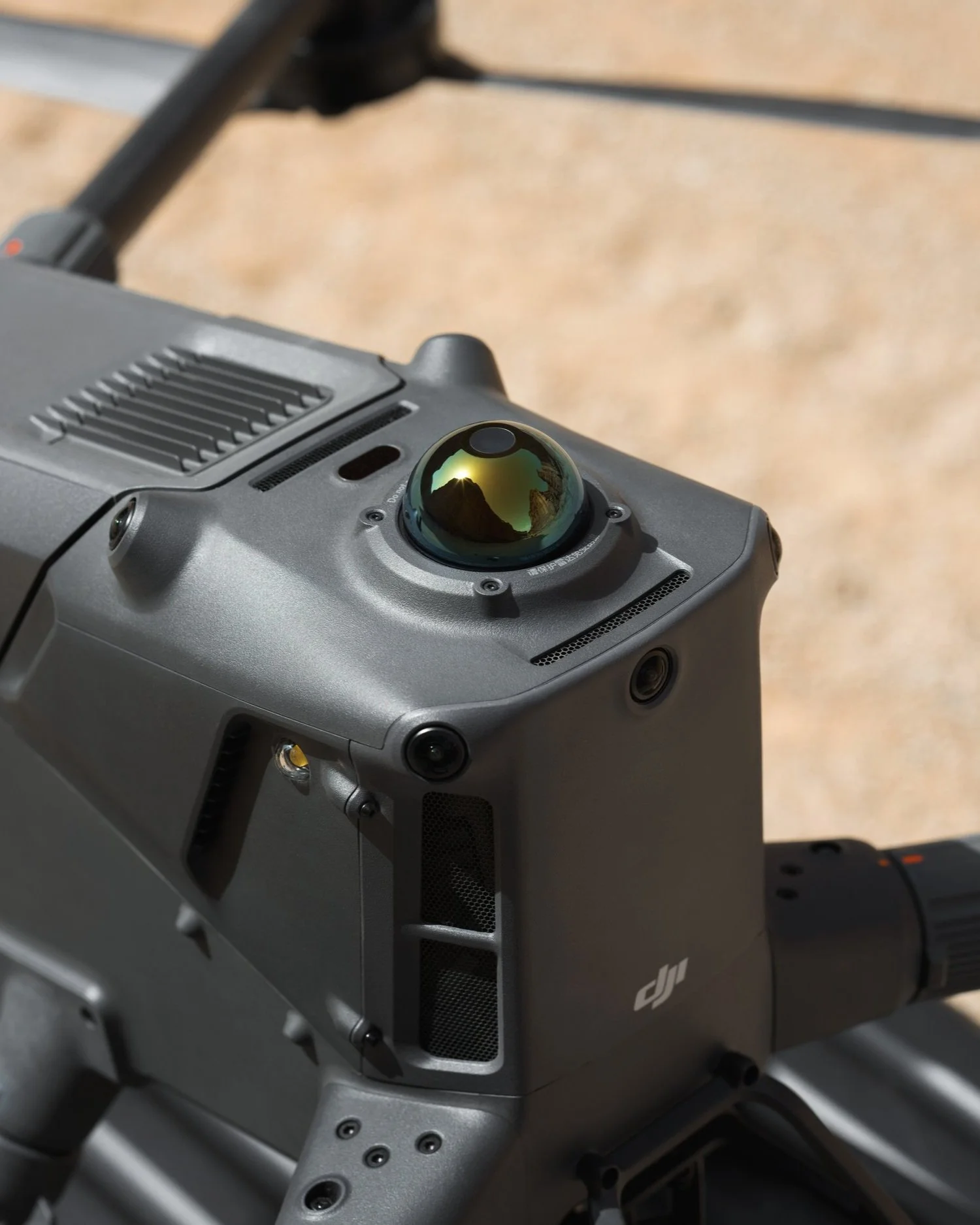
360° LiDAR Puck
Intelligent Features of the DJI Matrice 400
The DJI Matrice 400 Enterprise drone is packed with cutting-edge automation and intelligent capabilities that streamline complex workflows, enhance safety, and boost mission success. Here’s a breakdown of the M400’s key intelligent features:
-
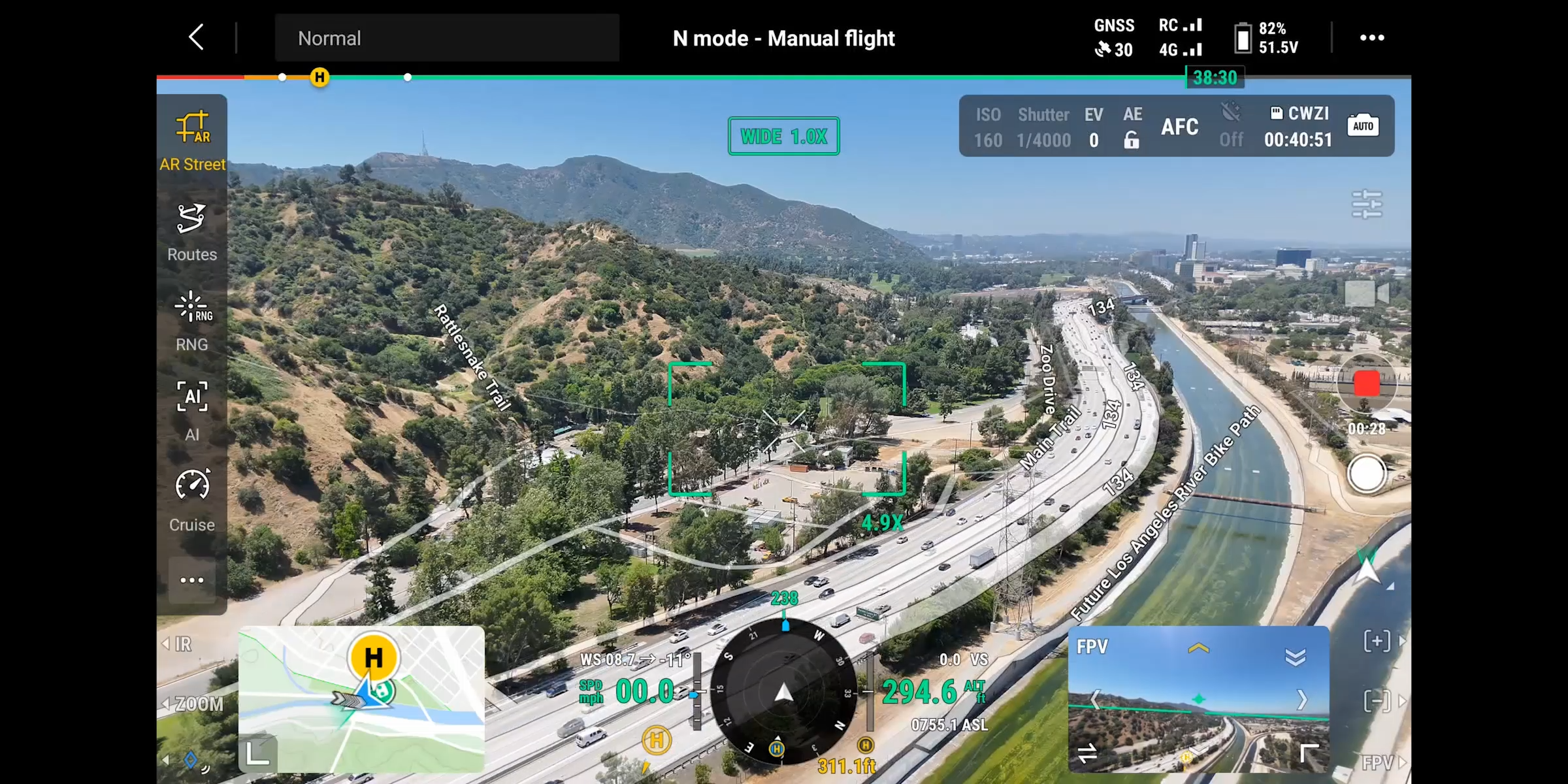
AR Power Line Detection: Automatically identifies overhead wires and displays them as augmented reality lines on the RC screen for safer power line inspections.
AR Map View: Displays real-time names of buildings, landmarks, and roads for better orientation in dense urban environments.
AR Flight Route Preview: Visualises flight paths during RTH, FlyTo, or obstacle avoidance to support better navigation decisions.
AR Landing Shadow: Helps operators visually align landings by projecting a virtual aircraft shadow.
These features enhance visual context and pilot decision-making during critical missions such as power grid inspections, urban surveying, and public safety operations.
-
Live Annotations: Mark points, draw lines, and define areas directly from the controller without 3D modelling. Automatically syncs with DJI FlightHub 2.
RC Signal Direction Prompt: Displays the aircraft’s relative position when the signal is weak, aiding in quick recovery and orientation.
Ideal for field teams needing quick geospatial data collection and real-time mapping collaboration.
-
Cruise Mode: Maintain forward flight without continuous stick input—perfect for linear asset inspections and long-distance missions.
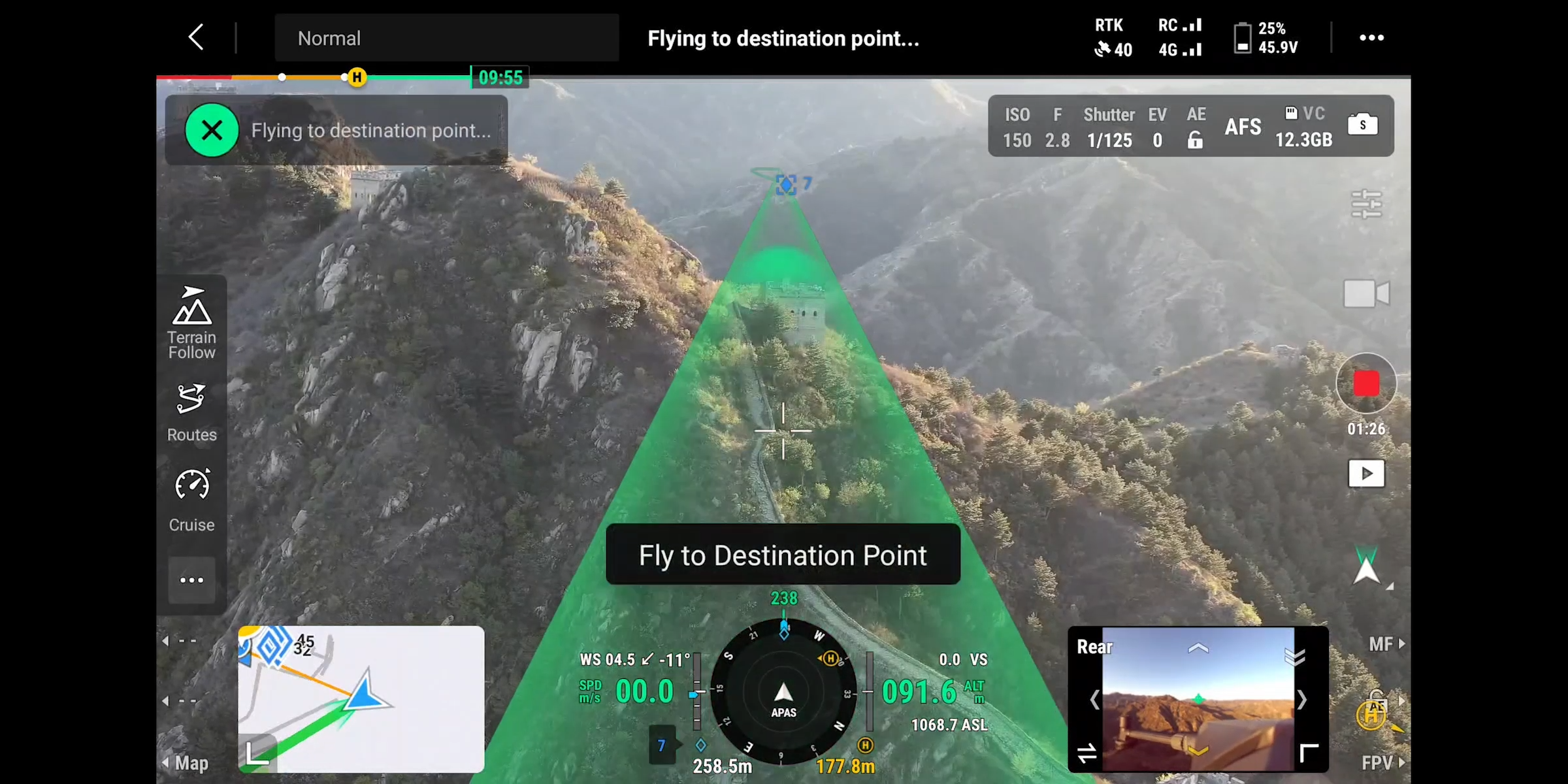
FlyTo: Auto-adjusts speed and path to navigate safely to a designated location.
Point of Interest (POI): Enables orbiting and 3D modelling around fixed objects like buildings, towers, and infrastructure assets.
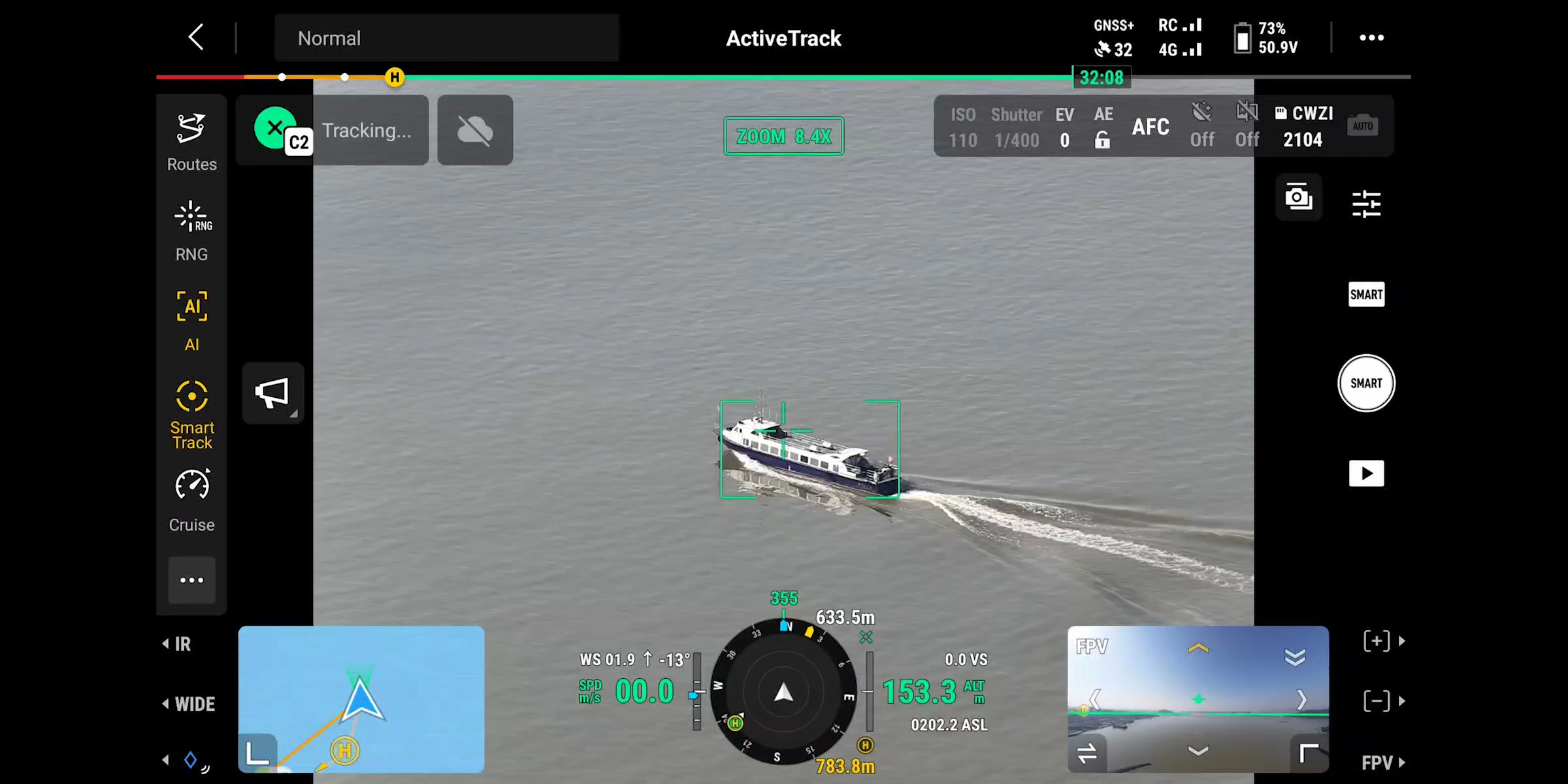
Smart Track: Locks onto and follows moving subjects with automatic zoom adjustments, great for search and rescue or surveillance.
Observed View: Marks observed ground areas on the map to reduce pilot workload.
Real-Time Terrain Follow: Maintains consistent height above ground in both manual and automated flights, ensuring stable mapping GSD and safer low-altitude flights.
-
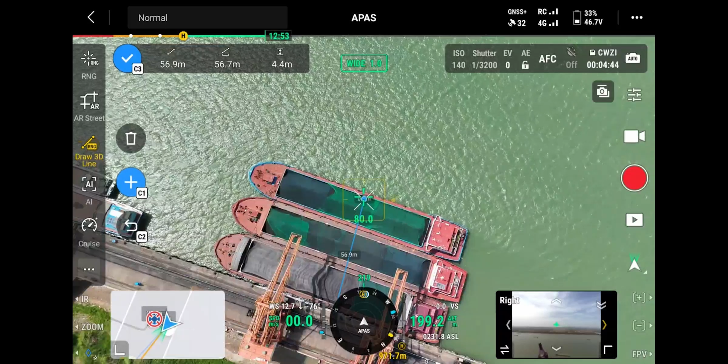
Slope & Geometric Routes: Supports advanced flight path planning for inspecting facades, inclined structures, or slopes using DJI Pilot 2 or FlightHub 2.
Smart 3D Capture (P1): Generates rough 3D models in real-time and visualises capture paths for safe execution.
25 m/s Mapping Speed (P1): Increased flight speed enables 60% faster 2D ortho collection, depending on payload and mission parameters.
These enhancements make the M400 an ideal platform for high-precision aerial surveys, geospatial data collection, and infrastructure mapping.
-
AI Detection (Visible & Thermal):
Detects people, vehicles, and boats using onboard AI models
Supports real-time alarms, object counting, and adjustable confidence thresholds
Compatible with the Zenmuse H30T for dual-spectrum detection
Supports search and rescue, law enforcement, and emergency response missions, even in low-visibility conditions.
-
Automatic Corridor Detection: Recognises power line paths and branch routes for autonomous inspection.
Point Cloud Collection: Live 3D point clouds are displayed on the controller in real time.
Bypass Line Crossing: A New safety feature for the M400 that detects and avoids intersecting power lines automatically.
A must-have for utility companies, energy providers, and infrastructure inspection teams.
-
Dynamic Vessel Recognition: Recognises custom landing markers placed on moving ships.
Safe Maritime Operations: Enables takeoff and precision landings on decks as small as 3×3 meters.
Dynamic Home Point & Visual Landing Assistance: Improves safety and expands mission reach in offshore and maritime scenarios.
Perfect for offshore inspections, coastal surveillance, and maritime security.


DJI RC Plus 2 Enterprise Controller
The DJI RC Plus 2 is the upgraded enterprise-grade controller designed for the Matrice 400 series and other DJI Enterprise drones.
Key Features:
7.02" LCD Touchscreen with ultra-bright 1400-nit display for outdoor visibility
High-Gain Antenna Array for stable long-range communication
IP54-rated weather-resistant build for rugged environments
Button Backlighting for low-light operation
Extended Endurance with up to 7 hours of operation using the WB37 external battery
Sub-2G Antenna System:
Dual-Band Support: Operates on 1.4 GHz and 900 MHz bands for reliable signal penetration and long-distance connectivity
Rear-Mounted Design: Improved signal performance with live status indication
4G Enhancement Module: Optional add-on for seamless integration with dual 4G drone modules
Ideal for BVLOS operations, urban inspections, and complex flight environments where signal reliability is critical.

Efficient and Intelligent Battery Systems
TB100 High-Capacity Flight Battery
Designed only for the DJI Matrice 400, the TB100 offers robust power and fast swappability.

Battery Specs:
Capacity: 20,254 mAh
Voltage/Type: Li-ion 13S, 977 Wh
Cycle Life: Up to 400 cycles
Top-Insert Design: Enables quick insertion/removal with ergonomic handle
Hot-Swap Capability:
Built-in capacitors allow 45 seconds of powered runtime during battery changes, maintaining GNSS lock and preventing mission interruption.
BS100 Multifunctional Battery Station
The BS100 is the intelligent charging hub built to support the demanding power needs of the M400 ecosystem.

Charging Capacity:
Supports 3× TB100 and 2× WB37 batteries simultaneously
Charging Modes:
Rapid Mode: 0–100% in 45 min @ 220V
Quiet Mode: Full charge in 110 min at both 220V and 110V
Charge Level Mode: Options for standby (90%) and full (100%) storage levels
Smart Management:
Real-time battery monitoring via the remote controller
One-tap firmware updates and auto-discharge setup
Ideal for fleet-level operations needing rapid and safe turnaround
TB100C Tethered Power System
The TB100C is DJI’s new tethered battery solution, offering continuous power via a cable connection for extended mission time.
Features:
Same specs as TB100: 20,254 mAh, 977 Wh, Li-ion 13S
Compatible with BS100 for in-box charging
Designed for Continuous Flight: Enables long-duration hovering or stationary operations when paired with third-party tethered power systems
Ideal for surveillance, maritime, and critical infrastructure monitoring, where endurance and stability are vital. Volarius has made a tether system compatible with the TB100C.
Final Thoughts
A New Standard in Enterprise Drone Operations
The DJI Matrice 400 isn’t just an upgrade; it’s a leap forward for enterprise drone technology. With more effective flight time than its predecessor, a 6kg payload capacity, and advanced obstacle avoidance that can detect power lines in low-light or mountainous terrain, the M400 is engineered for reliability in the most demanding environments.
From real-time terrain following and intelligent flight modes to ship-based takeoff and landing, the M400’s intelligent automation reduces operator workload and enhances mission efficiency. Whether you're in public safety, utilities, surveying, asset inspection, or maritime operations, the Matrice 400 adapts to your needs with robust payload support and unmatched operational flexibility.
As industries continue to demand smarter, safer, and more powerful aerial tools, the DJI Matrice 400 stands ready to lead the way.
Explore More with Prisma Technologies
Ready to upgrade your operations with the DJI Matrice 400? Explore our DJI Matrice 400 Bundles, designed to support industries such as public safety, surveying, utilities, and infrastructure inspection. Our knowledgeable team is here to help you find the right configuration, payloads, and accessories to suit your mission requirements. Contact us today at info@prismatech.com.au or call (02) 42 583 489 to speak with a specialist and unlock the full potential of the M400 platform.
Alternatively, contact us via the form below:
Or book a consultation: