
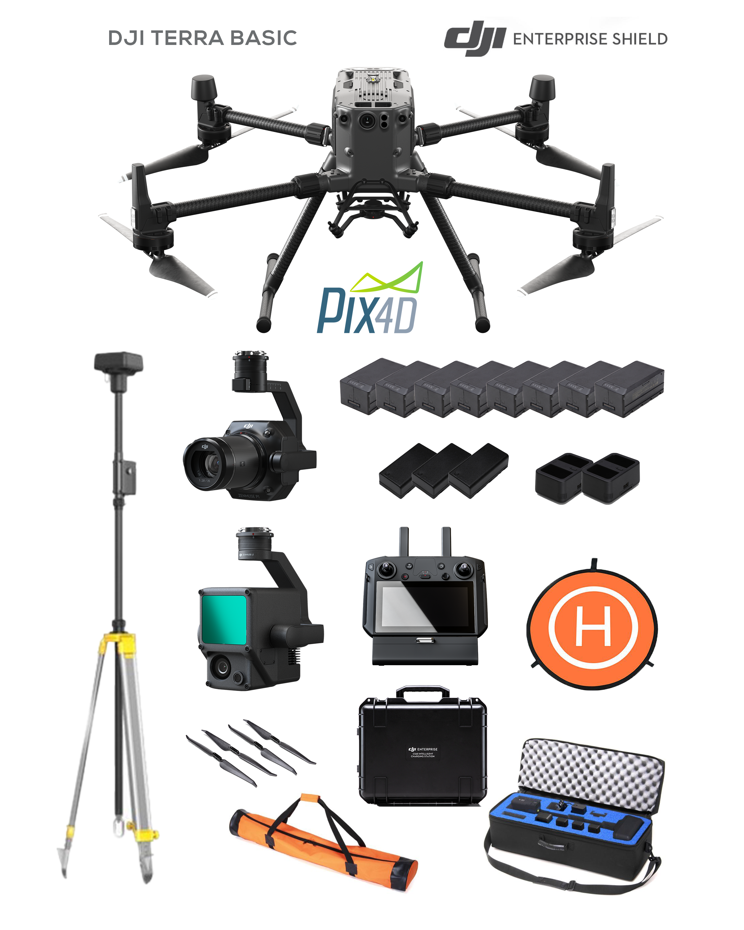

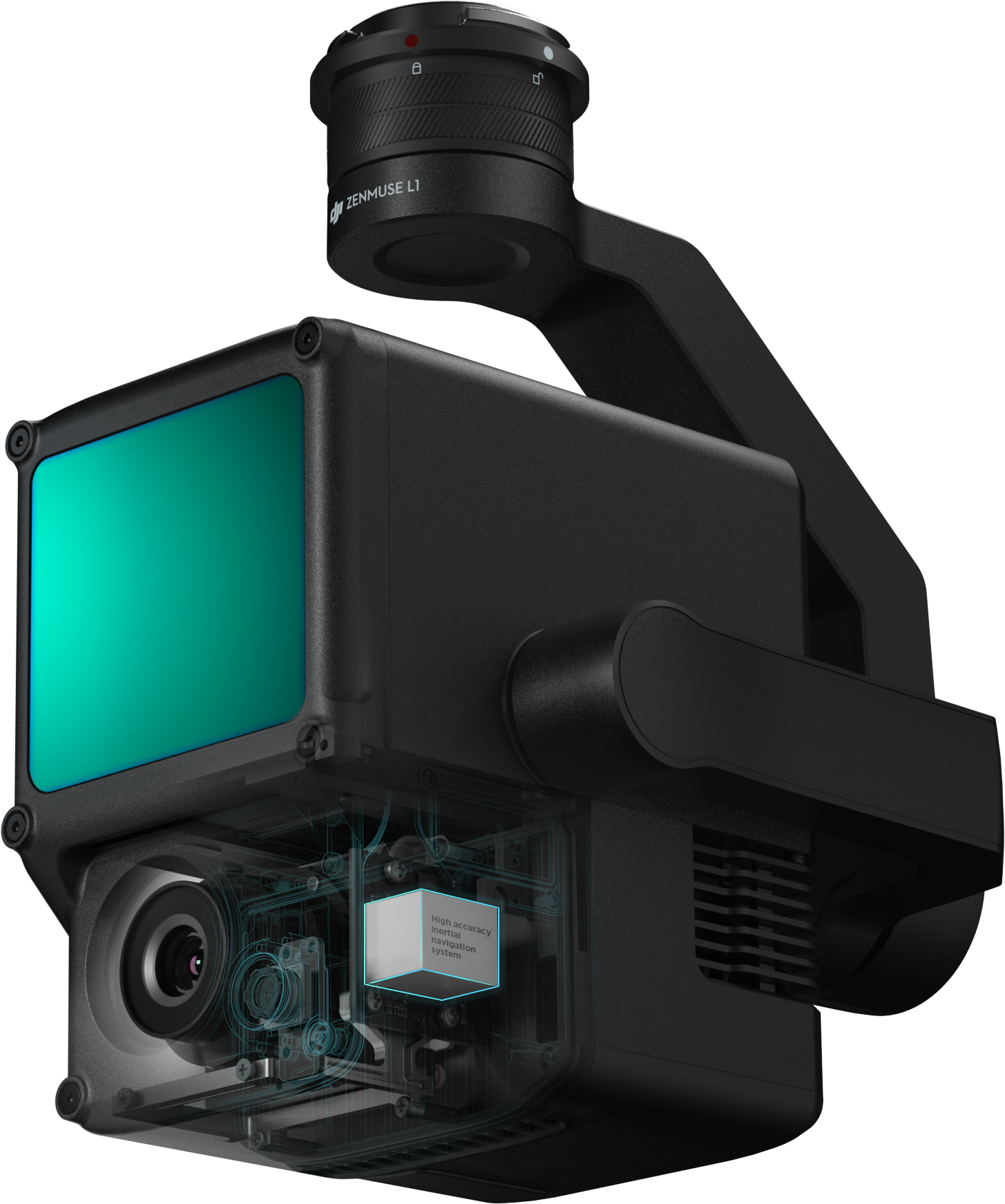

Livox Lidar Module
-Frame Lidar with up to 100% effective point cloud results
-Detection Range: 450m (80% reflectivity, 0 klx) / 190 m (10% reflectivity, 100 klx)
-Effective Point Rate: 240,000 pts/s
-Supports 3 Returns[3]
-Non-repetitive scanning pattern, Repetitive scanning pattern

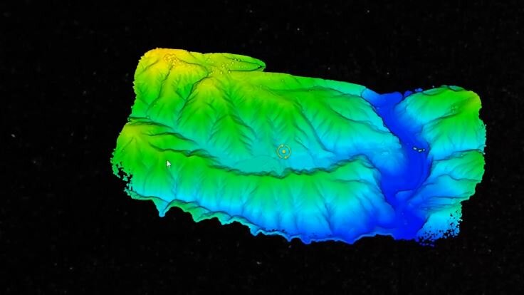
Recreate the World in 3D Point Clouds
Point Cloud LiveView
Real-time point clouds provide immediate insights onsite, so operators are informed to make critical decisions quickly. You can also verify fieldwork quality by checking point cloud data immediately after each flight.
Measurement and Annotation
Acquire and communicate critical dimensions on the point cloud model using measurements and annotations.
One-stop Post-processing
DJI Terra fuses the IMU and GNSS data for point cloud and visible light calculations, in addition to conducting POS data calculations so you can effortlessly generate reconstructed models and accuracy reports.

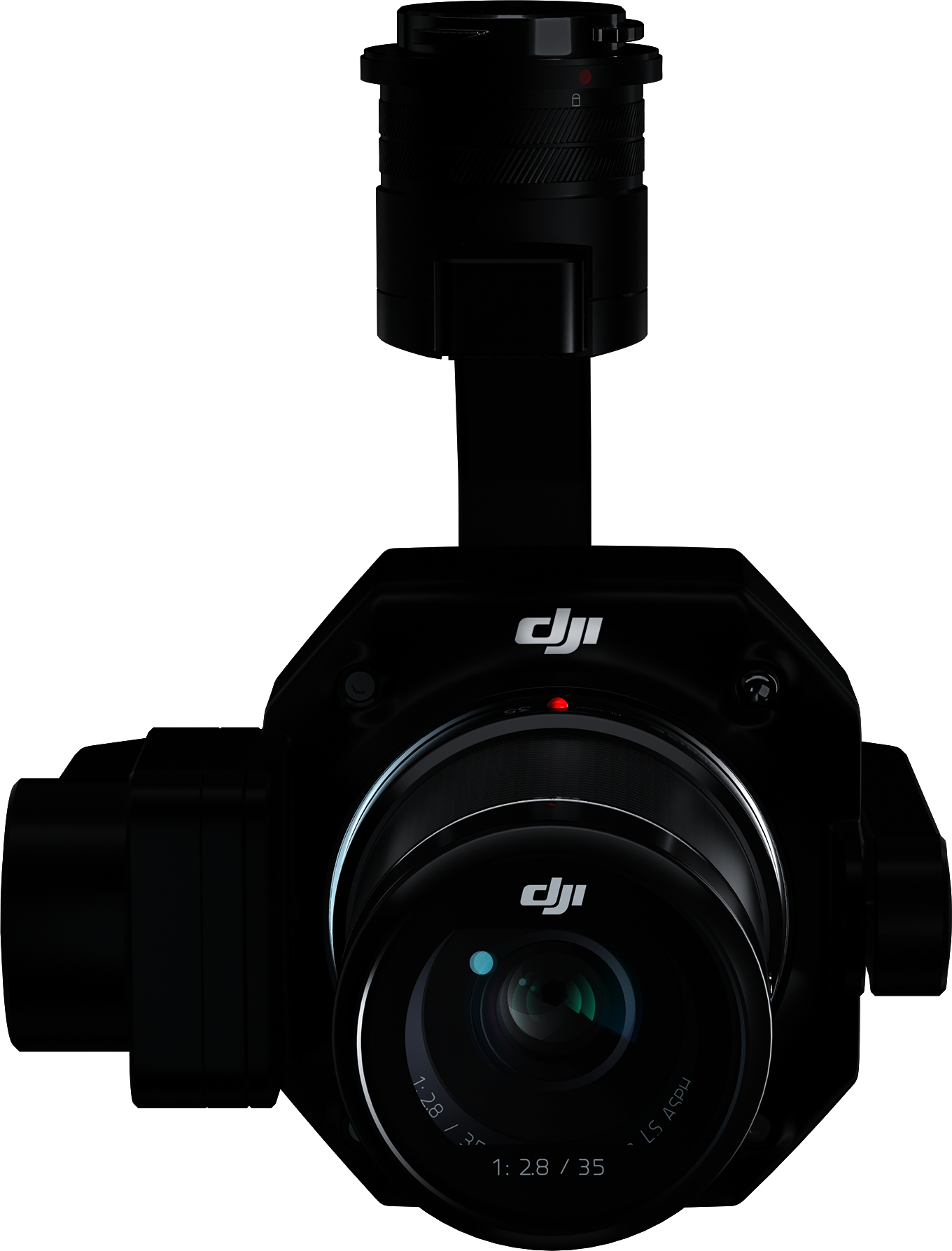
Full-frame Camera
- 45MP Full-frame Sensor
- 4.4μm Pixel Size
- Low-noise, high sensitivity imaging extends the daily operational time
- Take a photo every 0.7 s during the flight
- TimeSync 2.0 aligns the camera, flight controller, RTK module, and gimbal at the microsecond level
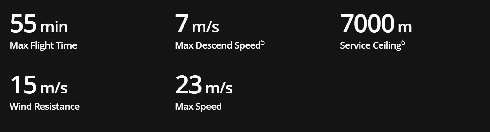
Enhanced Flight Performance
The refined airframe and propulsion system design gives you a more efficient and stable flight, even in harsh conditions.
Aviation-Grade Situational Awareness
The M300 RTK adopts a new Primary Flight Display (PFD) that integrates flight, navigation, and obstacle information to empower the pilot with exceptional situational awareness.

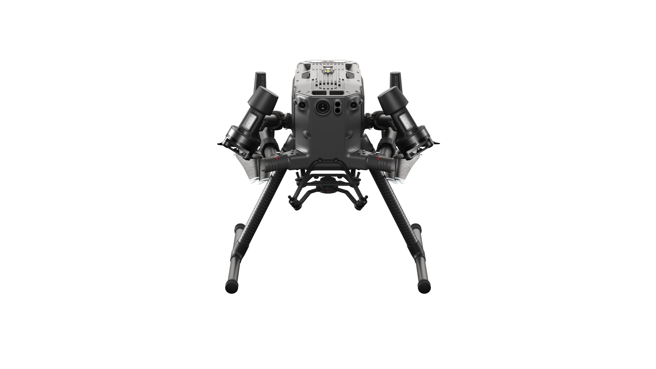
A Powerful Vision System You Can Rely On
To enhance in-flight safety and aircraft stability, dual-vision and ToF sensors appear on all six sides of the aircraft, offering a maximum detection range of up to 40 m, with options to customize the aircraft’s sensing behavior via the DJI Pilot App. Even in complex operating environments, this 6 Directional Sensing and Positioning system helps keep the aircraft and the mission safe.
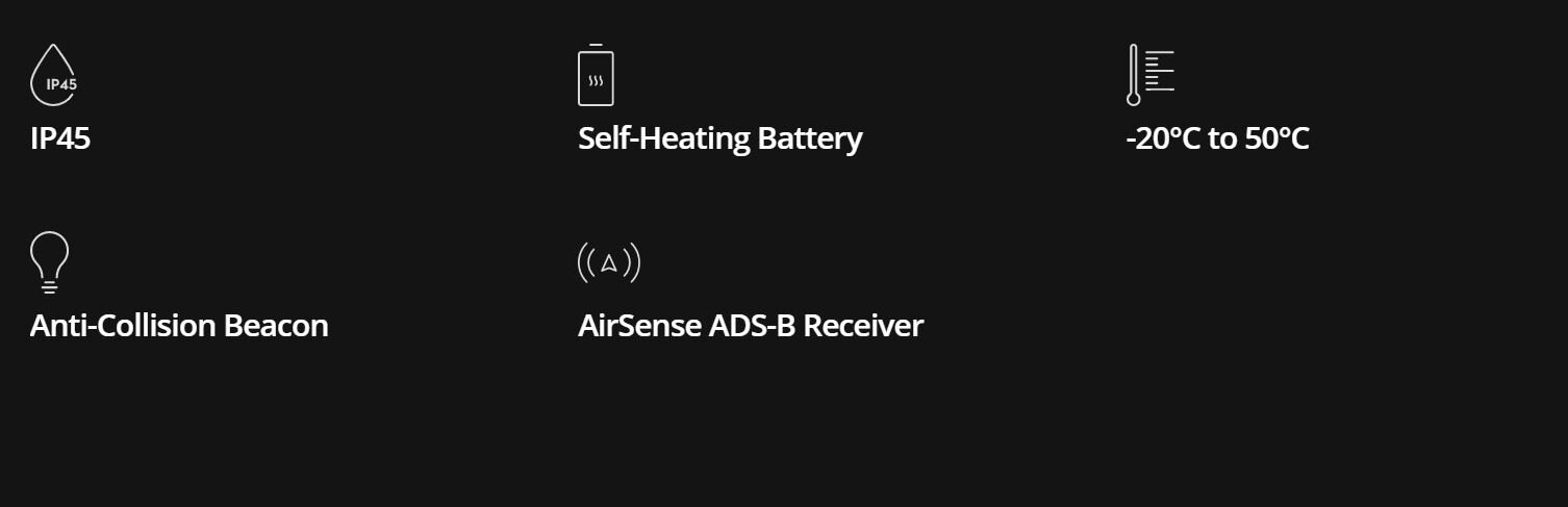
Redundancy Systems for Safer Flights
The M300 RTK’s built-in advanced redundancy systems help keep your critical missions going even in unexpected scenarios.
More Adaptable Than Ever Before
DJI TERRA - Make the World Your Digital Asset
Process point cloud data captured by the Zenmuse L1 in DJI Terra. In just one click, calculate POS data, fuse point cloud and visible light data, export point clouds in standardized formats, and generate fieldwork reports.
Photogrammetry Solution To Power Applications Across Industries
Advanced data processing for precise results. Generate high-resolution outputs for any project and use case. Easily export your digital maps and models to industry-compatible formats for further analysis or reporting.