
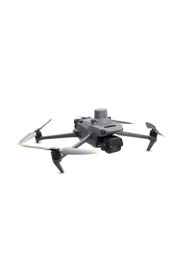
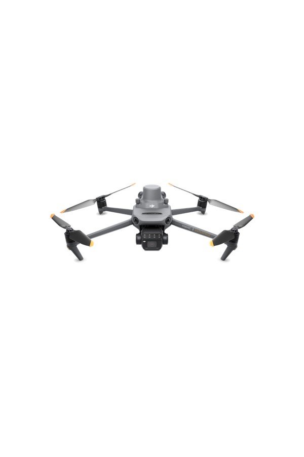
Compact & Portable
Foldable for easy storage
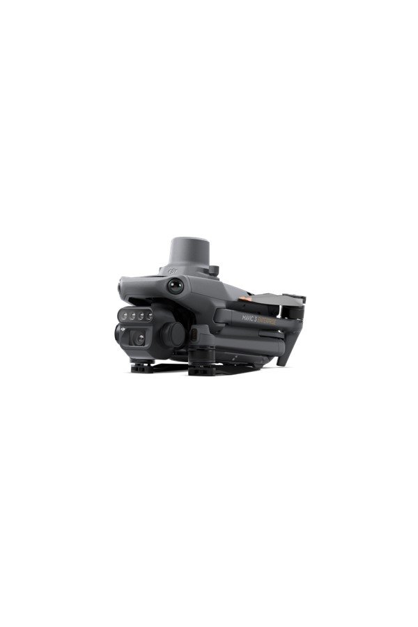
Multispectral Camera
4 × 5MP
G/R/RE/NIR
RGB Camera
20 MP
4/3 CMOS, mechanical shutter
Safe and stable
Omnidirectional Obstacle Avoidance
8km Transmission Distance (CE, Free of Interference, Line of Sight)
Precise Positioning
Centimetre-level RTK positioning
Microsecond-level time synchronization
Efficient Aerial Surveying
Up to 200 hectares per flight (In a sunny environment without wind, the orthographic flight aerial photography is obtained with a flight speed of 15 m/s, a flight altitude of 217 m, a ground sampling distance (GSD) of 5.73 cm for visible and 10 cm for multispectral, a fore-and-aft overlap rate of 70%, and a side overlap rate of 60%)
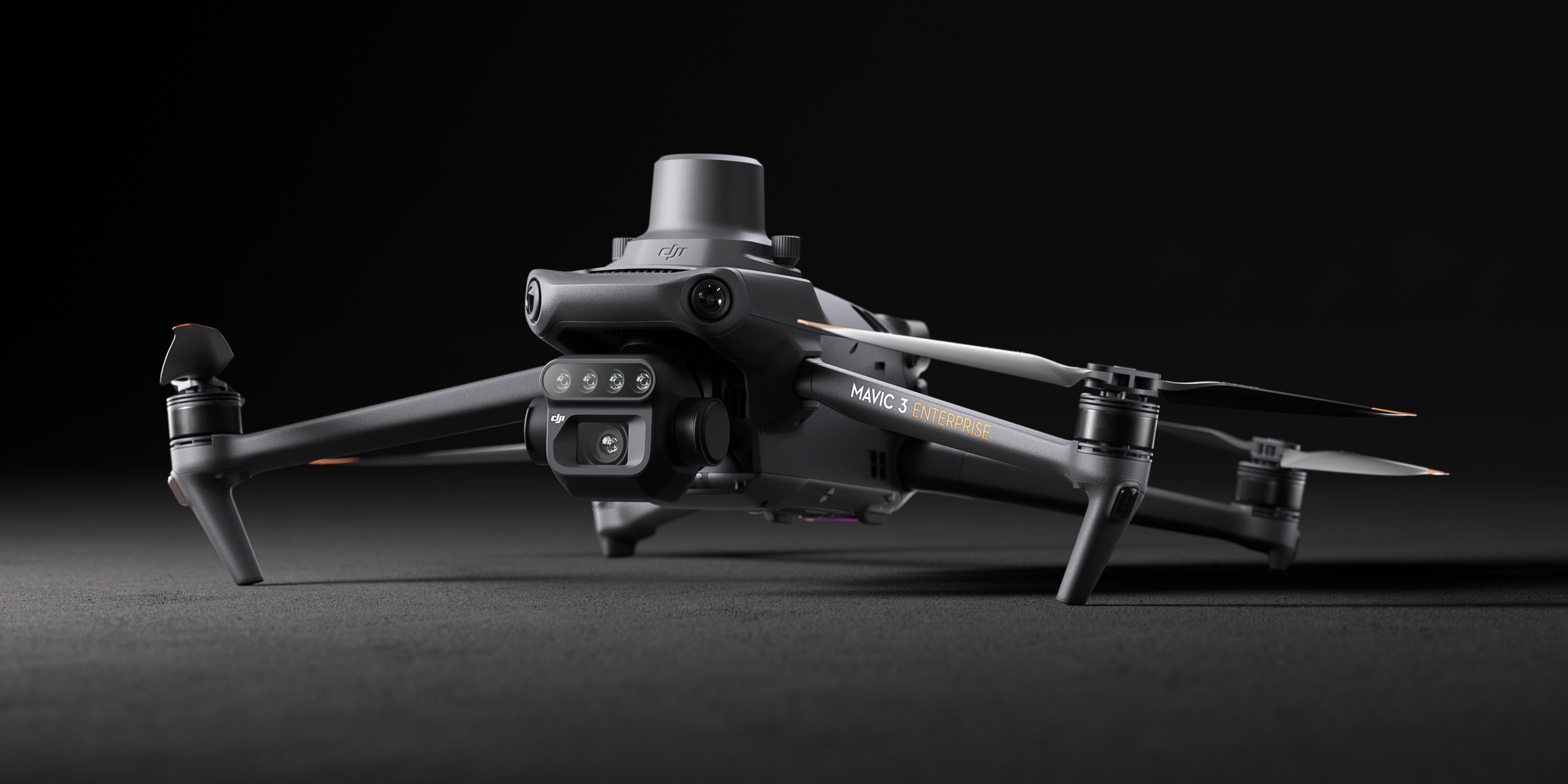
Multispectral + RGB Imaging System
Newly upgraded imaging system with one 20MP RGB camera and four 5MP multispectral cameras (green, red, red edge, and near-infrared). Enables applications such as high-precision aerial surveying, crop growth monitoring, and natural resource surveys.
NIR 860nm +/- 26nm
Red 650nm +/- 16nm
Red edge 730nm +/- 16nm
Green 560nm +/- 16nm
RGB Camera Characteristics
4/3 CMOS 20MP
1/2000s Mechanical Shutter Speed
0.7s High-Speed Burst When RGB Camera Is Used
Sunlight Sensor
The built-in sunlight sensor captures solar irradiance and records it in an image file, allowing for light compensation of image data during 2D reconstruction. This results in more accurate NDVI results and improved accuracy and consistency of data acquired over time.
RTK Module
Accurate images that capture every pixel
Mavic 3M with RTK module for centimetre-level positioning. Flight control, the camera, and the RTK module sync in microseconds to accurately capture the location of each camera's imaging centre. This enables Mavic 3M to do high-precision aerial surveying without using ground control points.
