


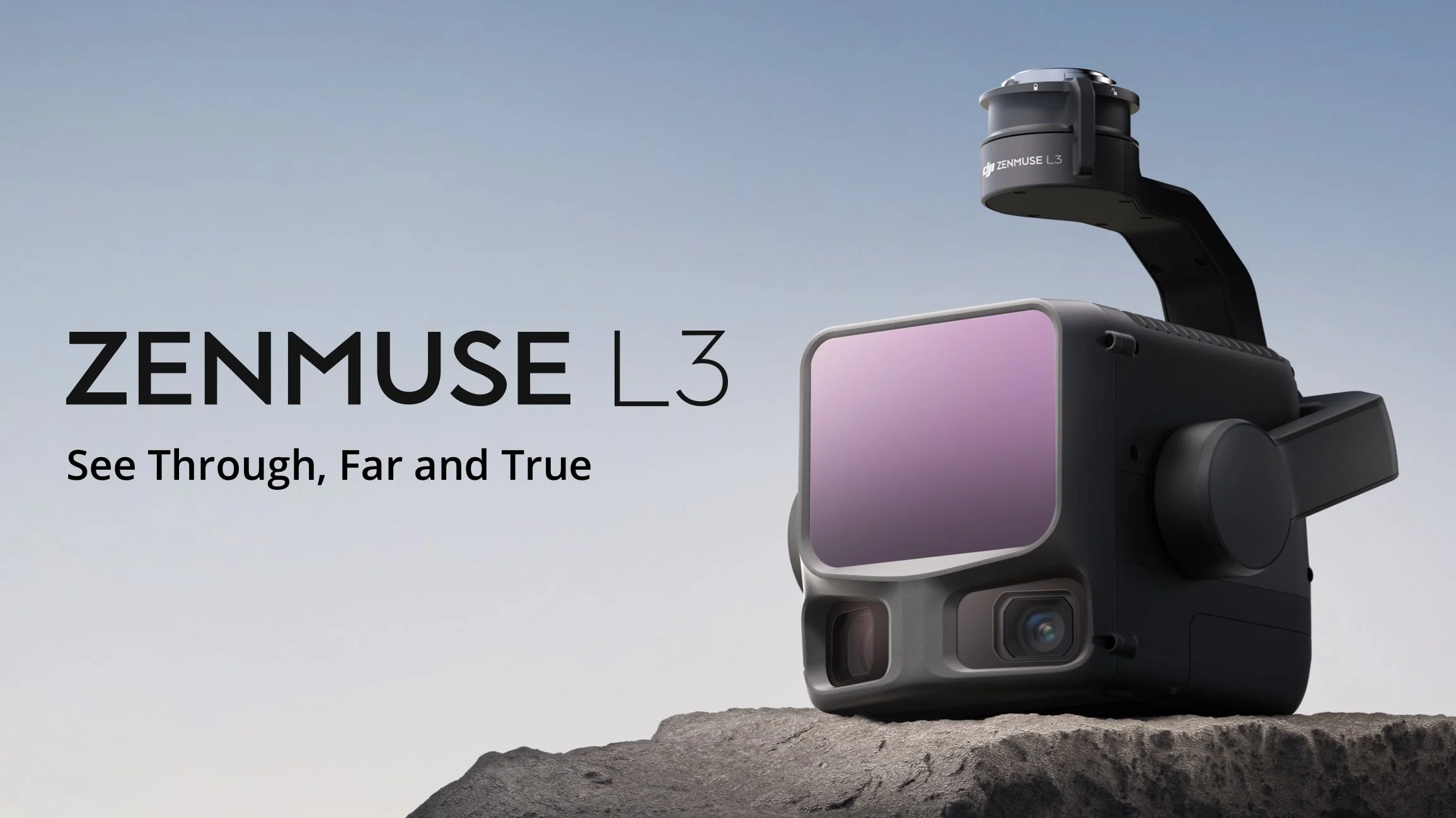
The DJI Zenmuse L3 is a next-generation, high-accuracy aerial LiDAR and RGB mapping system featuring a powerful, long-range LiDAR sensor with a detection range of up to 950 m (even at 10% reflectivity). Its dual 100 MP RGB cameras and high-precision POS integration deliver rapid, centimetre-level geospatial data capture, achieving daily coverage of up to 100 km²—ideal for surveying, infrastructure, and environmental applications.
1535nm Long-Range LiDAR
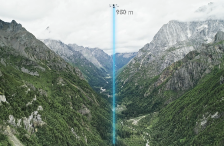
Long Range, Wide Coverage
The DJI Zenmuse L3 delivers exceptional long-range LiDAR performance with a maximum detection range of 950 m at 100 kHz pulse rate — even under 100 klx ambient light and on surfaces with 10% reflectivity. Its adjustable pulse rate provides flexible power output for optimal results across diverse environments, while typical flight altitudes of 300–500 m dramatically expand single-flight coverage and enhance overall mapping efficiency.

High Pulse Rate, Multiple Returns
The DJI Zenmuse L3 features an ultra-fast 2 million-pulse-per-second laser emission rate and supports up to 16 returns, enabling highly detailed and accurate 3D spatial reconstruction. Its adjustable point-cloud density and LiDAR penetration control allow operators to tailor performance for everything from high-precision mapping to complex terrain and vegetation environments.

Small Spot, High Energy
With an ultra-low laser beam divergence of just 0.25 mrad (1/e²), the DJI Zenmuse L3 delivers a spot size nearly five times smaller than the Zenmuse L2, enabling precise detection of fine objects such as power lines, tree branches, and cables. The higher energy density boosts LiDAR penetration capability, dramatically increasing ground point density beneath vegetation for high-accuracy terrain mapping and detailed 3D reconstruction.
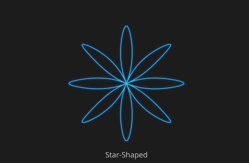
Scanning Modes
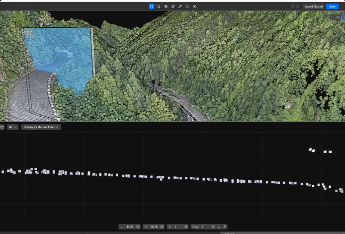
The DJI Zenmuse L3 supports Linear, Star-Shaped, and Non-Repetitive scanning modes, allowing users to optimise LiDAR performance for diverse operational needs. Linear Mode: Delivers uniform point-cloud distribution, ideal for high-accuracy terrain mapping and topographic surveys. Star-Shaped Mode: Combines multi-angle scanning with strong penetration capability, perfect for forestry, vegetation analysis, and dense urban mapping. Non-Repetitive Mode: Captures broader coverage with multiple scan angles, optimised for power line inspections, infrastructure surveys, and complex structural mapping.
Dual 100MP RGB Mapping Camera System
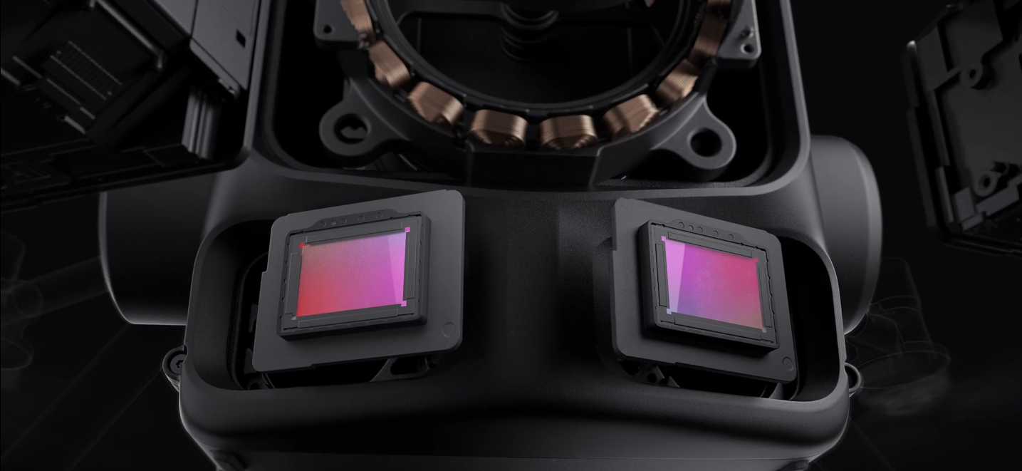
Dual 100MP RGB Mapping Cameras
The DJI Zenmuse L3 is equipped with dual 100 MP 4/3-inch CMOS RGB sensors and a mechanical shutter, delivering exceptional mapping accuracy and operational efficiency. Advanced pixel-binning technology provides an effective 25 MP resolution with larger pixel size, ensuring superior colour reproduction and high-quality imagery even in low-light or challenging conditions.

107° Ultra-Wide FOV
The DJI Zenmuse L3 features dual RGB mapping cameras with an ultra-wide 107° horizontal field of view (FOV), capturing significantly larger ground areas in each pass. Even with a 20% LiDAR side-overlap ratio, operators can simultaneously collect data for digital orthophoto maps (DOM) and digital elevation models (DEM) in a single flight — dramatically boosting mapping efficiency and reducing mission time.
Accuracy Meets Efficiency
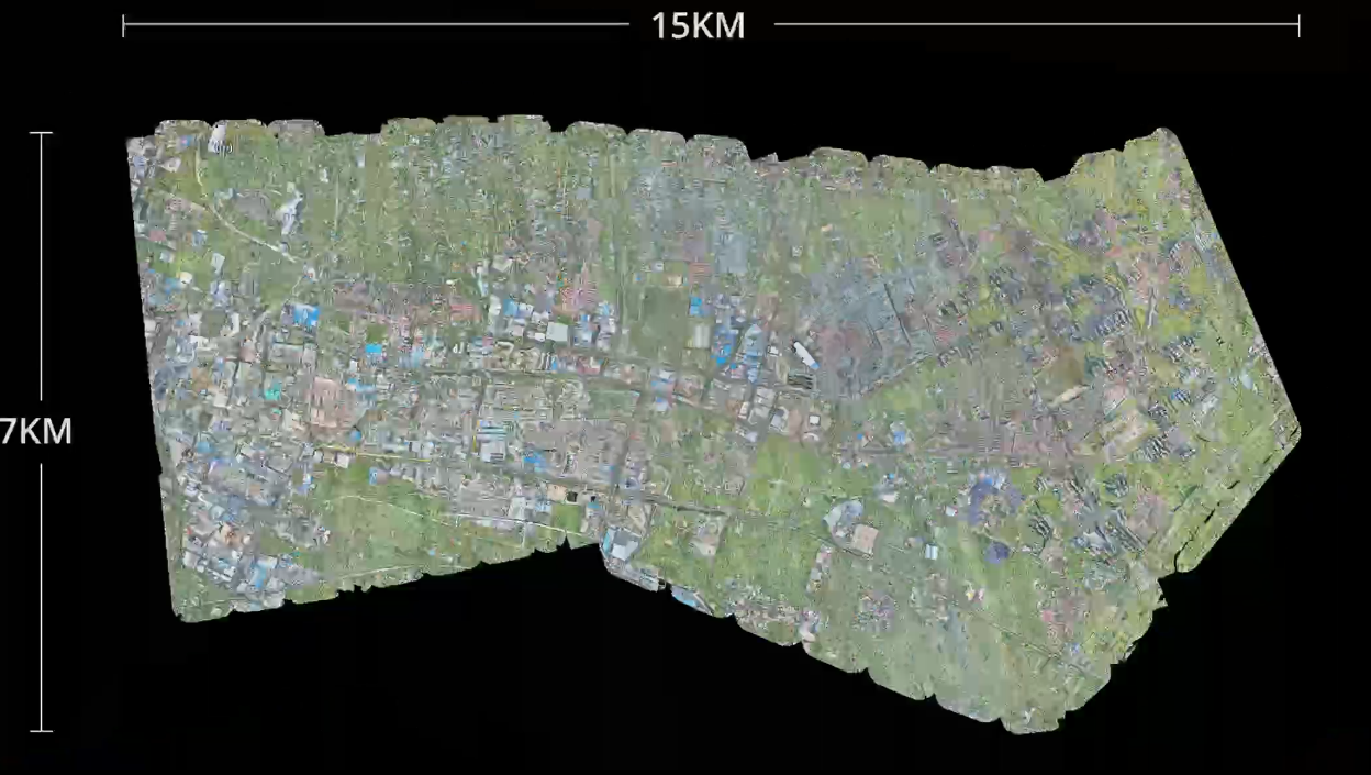
The DJI Zenmuse L3 sets a new benchmark in LiDAR mapping accuracy and efficiency, delivering superior point-cloud precision and RGB image fidelity. When paired with the DJI Matrice 400, a single flight can cover up to 10 km², enabling as much as 100 km² of high-accuracy mapping per day. The seamless workflow ensures large-area, high-resolution data capture for professional surveying, infrastructure inspection, and geospatial analysis.

Proprietary High-Precision System
The DJI Zenmuse L3 features an upgraded high-precision POS system delivering heading accuracy of 0.02° and pitch accuracy of 0.01° (1σ, post-processed) for exceptional geospatial precision. Its self-developed LiDAR module achieves ranging repeatability of 5 mm at 150 m with microsecond-level time synchronisation, ensuring precise point-cloud alignment. Every unit undergoes rigorous factory calibration, guaranteeing consistent, survey-grade accuracy across demanding mapping and inspection missions.
LiDAR Data Accuracy
The DJI Zenmuse L3 delivers exceptional vertical accuracy, achieving better than 3 cm at 120 m altitude, 5 cm at 300 m, and 10 cm at 500 m, making it ideal for 1:500, 1:1000, and 1:2000-scale mapping projects. Its refined LiDAR system produces point-cloud thickness nearly 50% thinner than the Zenmuse L2, enabling high-precision analysis, detailed terrain modelling, and advanced geospatial applications.

Photogrammetric Accuracy
Equipped with dual 100 MP RGB mapping cameras, the DJI Zenmuse L3 achieves an impressive 3 cm ground sample distance (GSD) even at 300 m flight altitude. Its real-time position synchronisation eliminates the need for ground control points (GCPs), delivering high-quality imagery and precise geospatial mapping for surveying, construction, and infrastructure applications.
High Penetration

High Ground Point Density
With a smaller laser spot size and higher single-pulse energy, the DJI Zenmuse L3 delivers exceptional LiDAR penetration capability for complex terrain mapping. It captures a higher density of ground points with greater completeness, dramatically enhancing the accuracy, integrity, and surface reconstruction of terrain data for high-precision mapping and 3D modelling applications.
High Efficiency
Up to 100km2 per Day
When mounted on the DJI Matrice 400, the DJI Zenmuse L3 delivers outstanding mapping efficiency. At a 300 m flight altitude, a single mission can cover up to 10 km², achieving as much as 100 km² of high-accuracy LiDAR and RGB data capture per day — ideal for large-area surveying, infrastructure mapping, and environmental monitoring.

Multiple Deliverables in a Single Flight
The DJI Zenmuse L3 simultaneously captures LiDAR and RGB data, producing a wide range of mapping outputs — including digital elevation models (DEM), digital orthophoto maps (DOM), and more — all from a single flight, streamlining your aerial surveying workflow.
End-To-End Solution
Delivers a complete workflow covering data capture, processing, and application.

Order Your Zenmuse L3 Today
Prisma Technologies – Important Caveats & Disclaimers (DJI Zenmuse L3)
Range Performance
a. The specified detection range represents the distance at which approximately 50% of emitted laser pulses are successfully detected. When the laser beam encounters multiple surfaces (e.g., vegetation or wires), signal power is divided, which may reduce the effective range.
b. Range values are derived under controlled test conditions (100 klx ambient light, 23 km atmospheric visibility, flat reflective target larger than beam diameter, perpendicular incidence, central FOV).
c. The default maximum detection range is 900 m.Mapping Coverage Reference
When paired with the DJI Matrice 400, the Zenmuse L3 can achieve up to 100 km² of daily mapping coverage under ideal conditions (flat terrain, >300 m AGL, 20% side overlap, 17 m/s speed, and 6 hours of total effective flight time).Actual results may vary based on terrain, weather, payload configuration, and operator proficiency.
Altitude Restrictions
Flight altitude limits are governed by local aviation regulations. Operators must ensure compliance with CASA and regional airspace rules in all missions.Laser Return Limitations
The 16-return LiDAR mode is supported only at 100 kHz and 350 kHz pulse emission frequencies. Higher pulse rates may reduce the number of supported returns.Environmental Test Conditions
Accuracy and repeatability specifications are based on laboratory testing at 25 °C, 80% object reflectivity, and 150 m range. Real-world performance will vary depending on lighting, reflectivity, humidity, and atmospheric clarity.Accuracy Verification Conditions
Precision metrics (e.g., vertical and horizontal accuracy) were validated under the following DJI test setup:Matrice 400 linked with a D-RTK 3 Multifunctional Station (position-calibrated).
Linear scanning mode with IMU calibration enabled in DJI Pilot 2, at 15 m/s flight speed, –90° gimbal pitch, and ≤ 3.3 km segment length.
Ground checkpoints conforming to diffuse reflection models were used.
Post-processing was performed in DJI Terra with Optimize Point Cloud Accuracy enabled.
Reference Documentation
For detailed formulas, calibration methods, and workflow settings, refer to the official DJI Zenmuse L3 User Manual available under Downloads on the DJI Enterprise website.Service & Warranty Plans
DJI Care Enterprise Plus coverage terms may differ by country or region. Customers in Australia should confirm local coverage with Prisma Technologies before purchase.Free Repairs: Provided within the coverage limit for eligible devices.
Fleet Coverage: Shared protection may be extended to other DJI Enterprise units bound within 30 days of first activation.
Free Shipping: Applies only to regions covered by DJI Care Enterprise. Customers are responsible for customs duties and logistics outside DJI’s coverage scope.
Refer to the DJI After-Sales Service Policy for full component coverage details.