Step 1: Capture
Capture images or point clouds with a drone or any laser scanner. When using a drone, automate and optimize your flights with the free PIX4Dcapture mobile app.

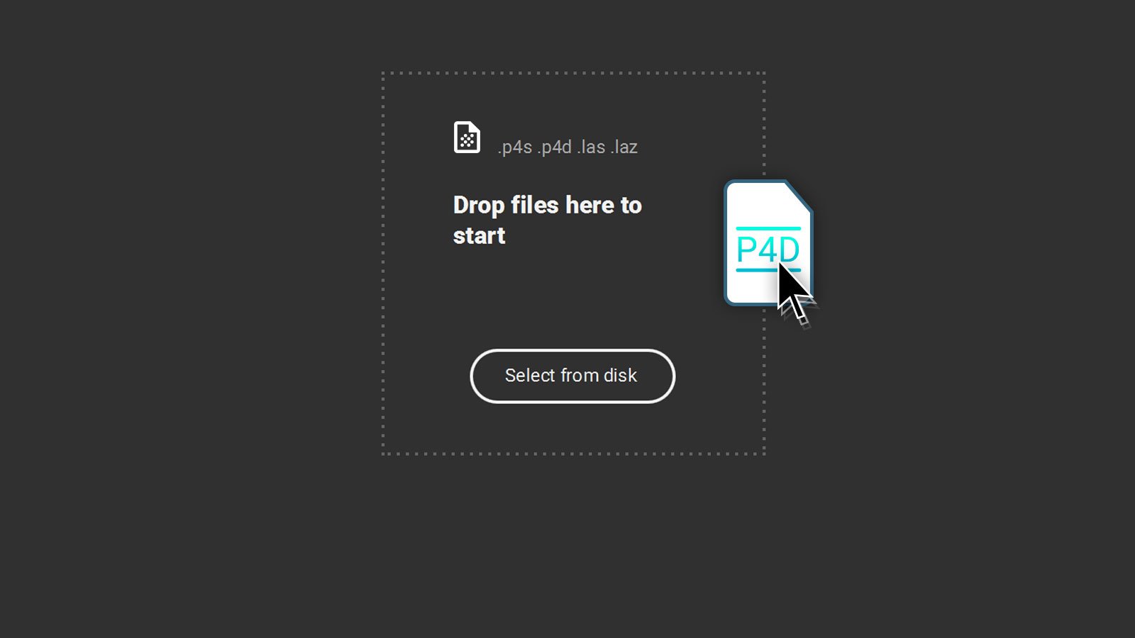
Step 2: Import
Import data from other Pix4D software or a .las or .laz file to PIX4Dsurvey and combine multiple datasets into the same project. Work with both imagery data and LiDAR point clouds.

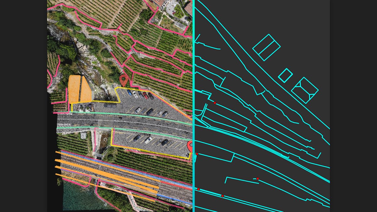
Step 3: Vectorise
Generate a TIN to model the ground and create engineering-ready CAD vector files from point cloud data by extracting key elements of your project with PIX4Dsurvey.

Step 4: Model
Move from a lightweight point cloud to a model of your terrain. Use the Smart Grid, TIN, and terrain classification to get accurate, actionable results

Step 5: Integrate
Open your simplified, accurate data in any CAD or GIS software with custom layers and properties that fit your existing workflow.

Beyond the point
Extract only the most relevant information to speed up and simplify your surveying workflows

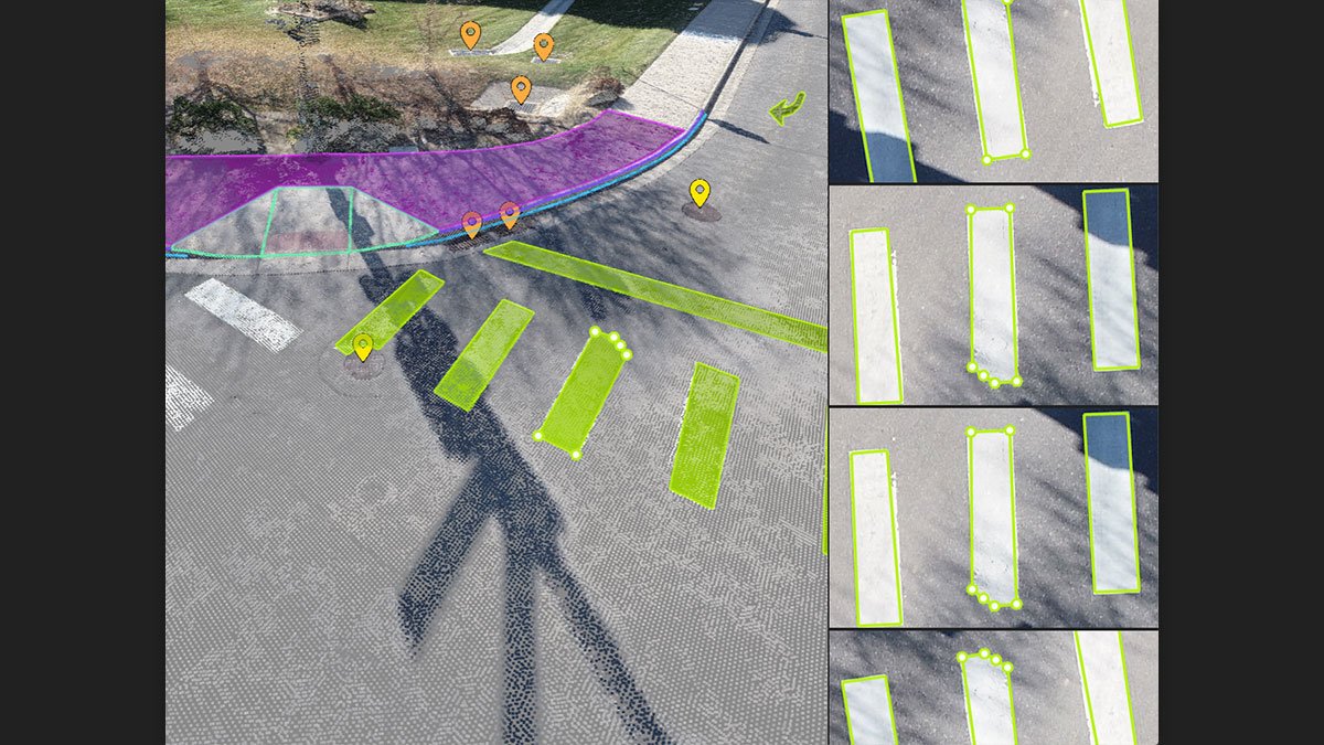
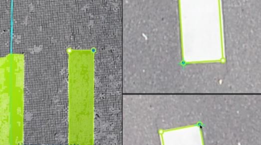
Extract key elements in 3D
Built-in vectorization tools
Vectorize your project using points, polylines, polygons and catenary curves with just a few clicks.
Measure volumes
Measure the volume of any object or space with straightforward steps.

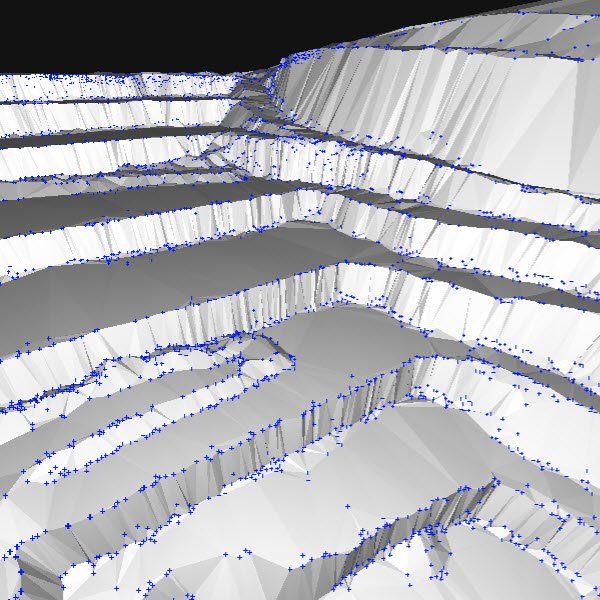
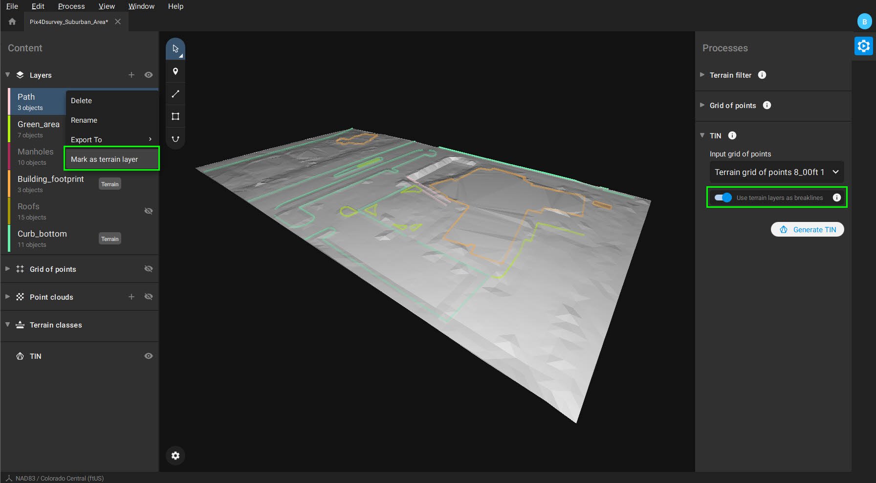
Create surfaces
Model the ground with a TIN from points and breaklines to represent the topography of your project. Automate the creation of spot elevations and allow drastic simplification of the number of point cloud points.
Unlock more data
Move beyond photogrammetry, yet still work with Pix4D’s rayCloud to access the original images and 3D point clouds simultaneously. Vectorize in 3D, edit in 2D. Survey complex objects only visible in images. Use color selection to pick a point and search in a defined radius for points of a similar color.
Scale-up
PIX4Dsurvey can handle billions of points. Work with as many point cloud files as you like in the same projects, including .las.

Integrated solution
PIX4Dsurvey works with your existing workflows. Import .p4d files from PIX4Dmapper, PIX4Dcloud, or .p4m files from PIX4Dmatic with the click of a button, or work with .las and .laz files from any device/source.
Easy export
Every surveyed object can be assigned to a layer and edited. Layers can be exported separately or together for a smooth transition to your preferred CAD or GIS software.
Your choice of point cloud
Import projects from PIX4Dcloud, PIX4Dmatic, PIX4Dmapper or any .las or .laz file.

From point cloud to TIN in a fraction of the time
Automate the creation of spot elevations and allow drastic simplification of the number of point cloud points. With a click, use this Grid of points to model the ground with a TIN.
Extract the same points you would use in the field with Smart Grid - it doesn't create any data, but instead reads the terrain class for locations of elevation change, just like your field crew would take spot elevations along breaklines.
Next up? Take that set of points & breaklines and create a DTM in LandXML format that exactly reflects the points you have told it to use. Now you are good to go in your CAD or GIS!