 Image 1 of 2

 Image 2 of 2


XGRIDS Lixel L2 Pro
Enquire Now
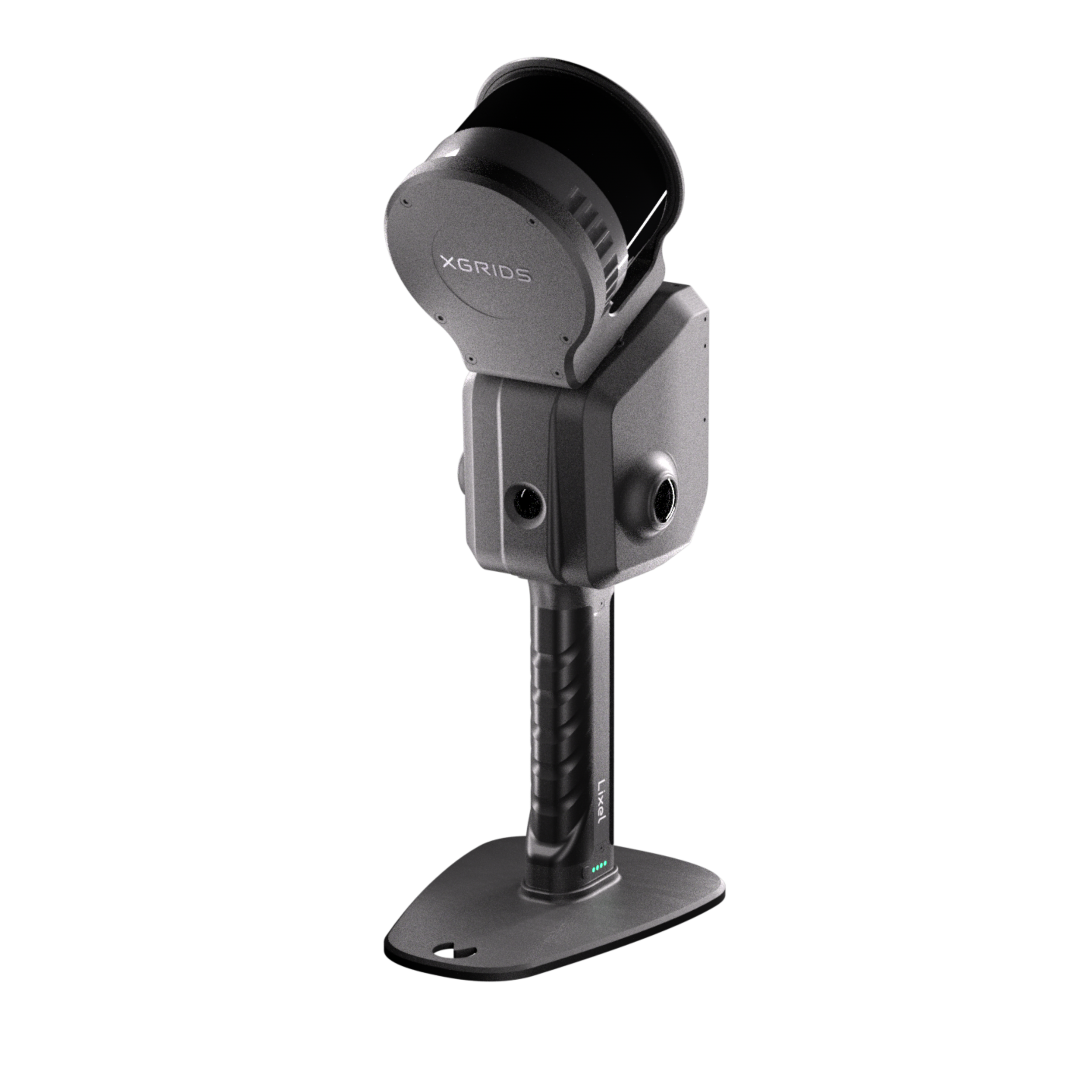
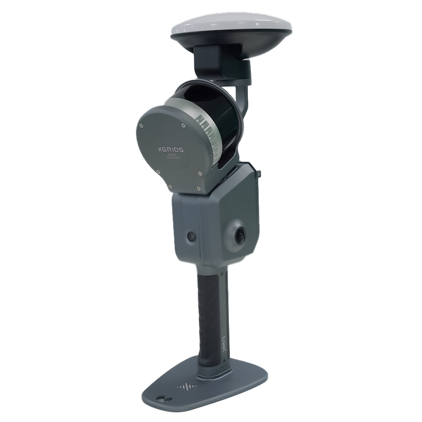
The XGRIDS Lixel L2 Pro is a hand-held LiDAR scanner that generates real-time, coloured point maps with high precision, ideal for surveying and mapping applications, such as building floor plans, archaeological site documentation, or forestry analysis. This fully integrated solution combines LiDAR for precision mapping and capturing fine details, panoramic cameras for providing rich colour and comprehensive visual context, and an onboard IMU to ensure accurate tracking of location and movement, even in challenging environments. The 16 Channel model supports 120m range Its all-in-one portable design makes it perfect for detailed modelling in confined spaces, such as underground tunnels, narrow hallways, or complex machinery.
Model Variations:
16 Channel: 120m Range at 320,000 points/s
32 Channel: 120m Range at 640,000 points/s
32 Channel: 300m Range at 640,000 points/s
Includes:
1x XGRIDS Lixel L2 Pro
1x XGRIDS Survey Grade RTK Module
Optional Accessories:
Supporting Harness
Phone Mount
Extension Pole
Mini RTK Module
AVAILABLE TO ORDER
XGRIDS Lixel L2 Pro
The XGRIDS Lixel L2 Pro is a hand-held LiDAR scanner that generates real-time, coloured point maps with high precision, ideal for surveying and mapping applications. Whether you need to create building floor plans, document archaeological sites, or conduct forestry analysis, the Lixel L2 Pro is the perfect solution.
This fully integrated system combines:
LiDAR for Precision Mapping: Equipped with a Class 1 laser operating at 905nm, the LiDAR sensor provides 1mm and 5mm LiDAR modes and offers the following variations:
16 Channel: Scanning range of 0.5m to 120m at 320,000 points per second.
32 Channel: Scanning range of 0.5m to 120m at 640,000 points per second.
32 Channel (Extended Range): Scanning range of 0.5m to 300m at 640,000 points per second.
Panoramic Cameras: Features 2×48MP cameras with a 190°×190° field of view, capturing high-resolution images to provide rich colour information and comprehensive visual context, ideal for visual positioning and scene documentation.
Onboard IMU: Integrates a high-precision Inertial Measurement Unit (IMU) to track movement and orientation accurately, providing stable positioning even in environments with limited GPS signal, such as underground or indoor spaces.
Key Features:
Real-Time Coloured Point Mapping: Visualise detailed maps instantly with colour information for enhanced clarity.
Portable All-in-One Design: Perfect for working in confined spaces such as underground tunnels, narrow hallways, or complex machinery.
High Precision Data Capture: Designed for professionals requiring highly accurate data for surveying, mapping, or modelling.
Durable Build: Rated IP54 for dust and water resistance, ensuring reliable performance in tough environments.
Lightweight Design: Weighs 1.7 kg without battery, making it easy to handle during extended use.
Battery Life: Provides an operating time of 1.5 hours and features a 46.8Wh battery that is easy to charge and replace.
Storage Capacity: Equipped with a 1TB SSD for storing extensive point cloud data and images.
Wireless Module: Supports WiFi and Bluetooth, making it convenient to transfer data without physical connections.
Why Choose XGRIDS Lixel L2 Pro?
Versatile Applications: Suitable for a wide range of surveying and mapping needs, from architectural planning to environmental analysis.
Cutting-Edge Technology: Integrates LiDAR, cameras, and IMU in a seamless package, offering a comprehensive mapping solution.
Portable and User-Friendly: Lightweight and ergonomic, making it easy to carry and use, even in difficult environments.
LixelGO Mobile App:
The LixelKity K1 works seamlessly with the LixelGO mobile app, which offers real-time control, visualisation, and data management. Key features of LixelGO include:
Real-Time Data Synchronisation: Connects via WiFi or 4G/5G, allowing users to manage projects and view data live.
Project Management: Enables easy management of multiple scanning projects directly from your smartphone, ensuring data organisation and access are streamlined.
LixelStudio: All-in-One Point Cloud Processing Software
The LixelStudio software complements the Lixel L2 Pro by providing an all-in-one solution for processing the captured point cloud data. Powered by advanced spatial intelligence algorithms, LixelStudio offers:
One-Click Processing: Easily process point cloud data to improve precision and visual quality.
Panoramic Overlay: Allows for seamless integration of panoramic views into measurement and modelling workflows.
Map Fusion: Combines multiple datasets for complete, large-scale point cloud data.
Advanced Editing Tools: Offers registration, noise removal, length and area measurement, 3D clipping, and more to refine your data.
Rich Rendering Modes: Supports various rendering modes including RGB, intensity, elevation, and EDL, providing diverse visualisation options.
Accuracy Report: Verifies point cloud accuracy manually or automatically and generates detailed reports.
Industry Applications: Features like stockpile measurement comparison and auto mesh generation, tailored to meet diverse industry needs.
Version 3.0 Upgrades:
Device Detection: Automatically recognises the connected Lixel L2 Pro, streamlining setup.
New Licensing Options: Offers both online and offline licensing options for more convenience.
Faster Processing: Supports the latest formats for efficient, day-to-day data management.
Updated UI Design: Features both light and dark modes for a user-friendly experience.
Take your surveying and mapping projects to the next level with the XGRIDS Lixel L2 Pro and the LixelStudio software. Order yours today!
